- /
- Site Preparation
- /
- Mechanical (Excavator/Barge)
- /
- Site Preparation: Mechanical – 3.0 River Protection

Disturbance of riparian vegetation along the banks of the extraction area creates potential channel erosion. Bottom scouring also further leads to the collapse of the riverbank in the absence of stable riparian vegetation or suitable engineering protection works.
Protection of riverbank from river channel erosion.
3.1.1 Appoint a surveyor to determine the riparian buffer boundary based on the width specified in the EIA/AEC.
3.1.2 Mark the riparian buffer boundary with sturdy materials such as painted wooden stakes, iron bars, or PVC pipes in easily visible areas.
3.1.3 Erect riparian buffer boundary signboards on the field (in visible areas) and specify the width on the Refer to Plates 7 and 8.
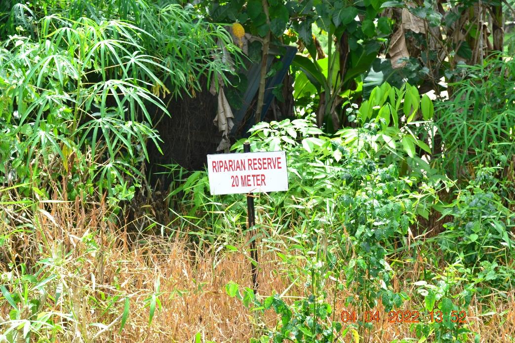
Plate 7: Riparian buffer boundary marked with signboard.
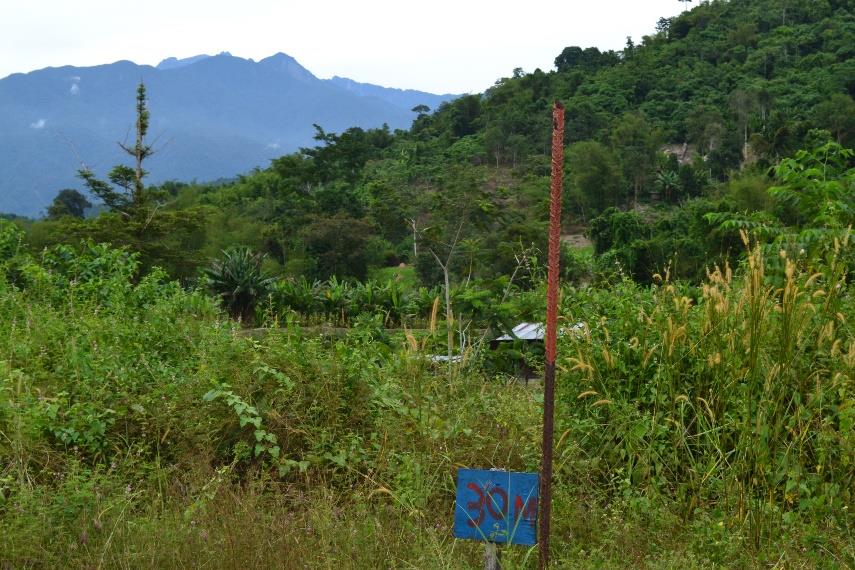
Plate 8: Marking tools with signage for riparian buffer.
3.1.4 All workers should be made aware of the riparian buffer marking to avoid encroachment.
3.1.5 Conduct patrolling activities along the riparian buffer boundary to check the condition of the boundary marking tools and signage.
3.2.1 Prohibit construction of any project facilities (e.g, workers’ quarters, workshop, stockpile, sand-washing, sedimentation pond, sanitary facilities ) within the riparian buffer.
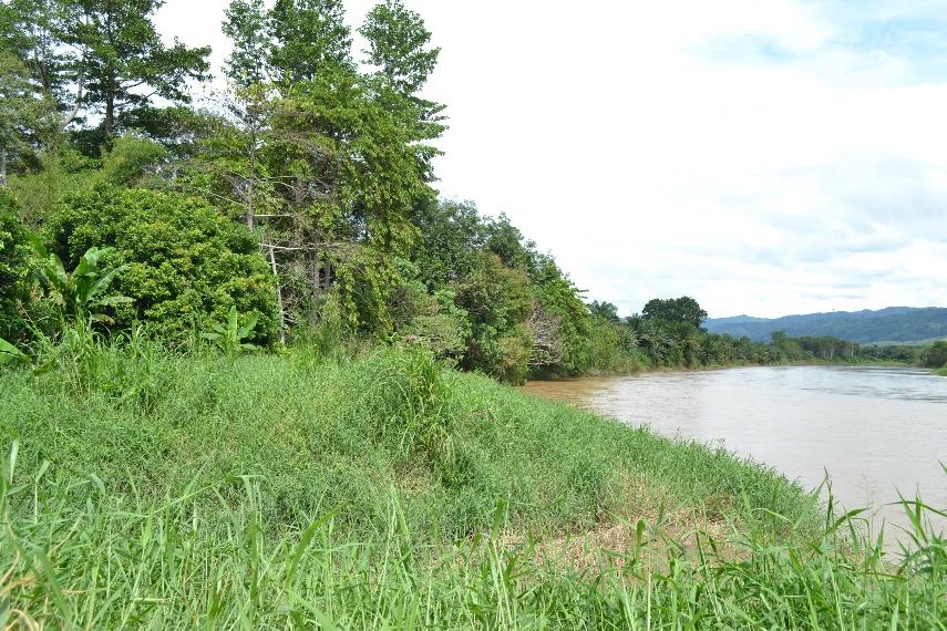
Plate 9: No disturbance to the riparian vegetation.
3.2.2 Prohibit the storage of oil materials within the riparian buffer.
3.2.3 Prohibit the disposal of any waste, earth materials, sewage, and/or chemical substances within the riparian buffer or into rivers/waterways.
3.2.4 Notify DID in writing if vegetation clearing is to be conducted within the provisioned riparian Permission from DID needs to be obtained prior to any clearing within the riparian buffer.
3.3.1 Erect and select a riverbank erosion indicator or marker along the riverbank based on the map in the AEC and/or river survey Take photographs with coordinates and dates, and compare periodically. Refer to Appendix 1 for riverbank erosion monitoring.
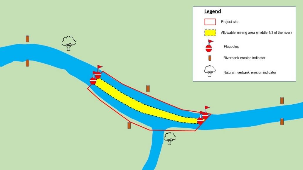
Figure 8: Illustration of riverbank indicator
3.3.2 Appoint a licensed surveyor to conduct river mapping based on the frequency stated by The survey shall include the cross-sectional plan and longitudinal plan, and is submitted to DID. Support the surveyed area with an aerial image and submit it to DID. The approved plan shall be submitted to EPD.
3.3.3 If erosion occurs and it is proven that erosion was caused by sand mining activities, consult with DID on appropriate riverbank protection The cost of riverbank rehabilitation shall be borne by the proponent. There are several methods for protecting the riverbank based on the DID guideline:
3.3.4 If riverbank protection is deemed necessary, appoint a civil engineer to design the riverbank protection structures and submit it to DID for their approval.