- /
- Site Preparation
- /
- Hydraulic (Pontoon)
- /
- Site Preparation: Hydraulic – 2.0 Processing and Stockpile Area

Establishment of processing and stockpile areas at unsuitable or prohibited locations cause adverse environmental impacts in terms of potential water pollution as well as disturbance to riparian habitats.
Protection of water quality and riparian habitat by controlling activities at processing and stockpile areas.
2.1.1 Erect a project signboard at the site entrance with size 5 m x 2.0 m. The project signboard shall consist of the following information:
2.1.2 Install a warning signboard at the site entrance or erect a warning signboard at the location shown in the figure of the AEC to warn the public against trespassing in the processing area.
2.1.3 Apply wayleave from the Public Works Department (PWD) for the erection of the project signboard located at the road reserve.
2.2.1 Mark all corners of the processing site boundary using sturdy materials at visible locations and as specified in the Boundary marking tools that can be used include painted wood stakes, signboards and zinc hoarding.
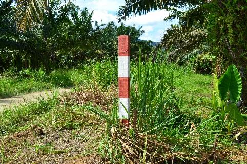
Plate 5: Marking of boundary using wooden stake painted with red and white.
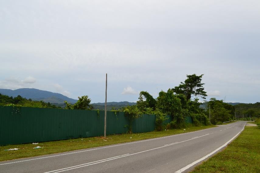
Plate 6: Marking of boundary with zinc hoarding.
2.3.1 Mark the buffer boundary at locations indicated in the AEC before the commencement of any project activities with visible boundary markers made from sturdy Boundary markers that can be used include painted wooden stakes, signboards or PVC pipes.
2.3.2 Provide buffer based on the width stated in the AEC.
2.3.3 Use different buffer boundary markers from the site boundary For example, use red-painted wooden stakes to mark the site boundary and yellow-painted wooden stakes to mark the setback or buffer areas boundary.
2.3.4 Prohibit any activities within the buffer area.
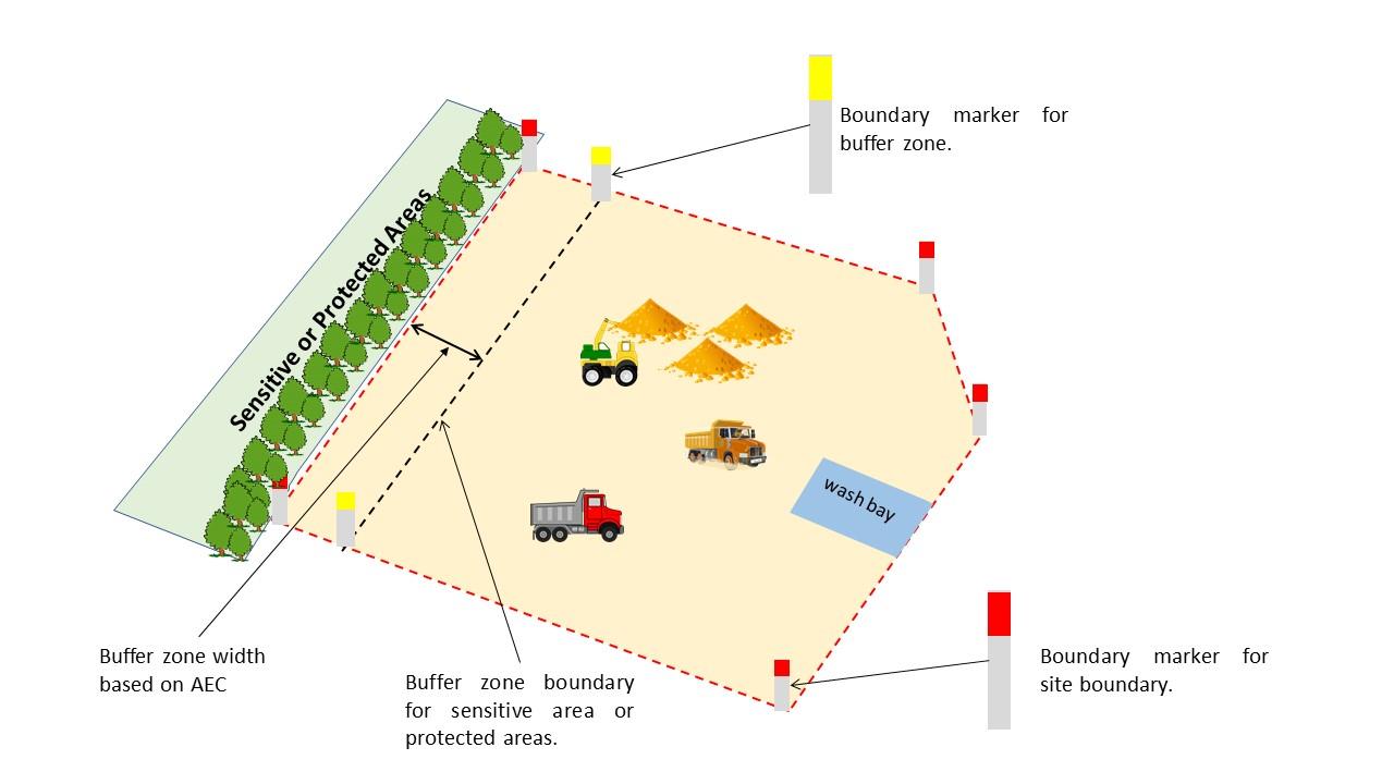
Figure 7: Illustration showing site boundary marking and buffer for sensitive or protected areas.
2.4.1 Inspect or monitor the marking tools for site and buffer boundaries Conduct maintenance or repair when necessary.
2.4.2 All workers must be made aware of the site and buffer boundaries marking tools erected/installed on-site to prevent them from being removed or damaged.
2.4.3 Prohibit all processing activities outside the processing boundary.
2.5.1 Identify the location of the site facilities based on the mitigation map in the AEC.
2.5.2 Conduct minimal vegetation removal for the area designated for the establishment of site facilities.
2.5.3 Establish site facilities (e.g., workers’ quarters, stockpile, crusher plant, sand screening plant) at a minimum horizontal distance of 30 metres away from the top of the bank (of the nearest river or watercourse) or distance specified in the AEC.
2.5.4 Established workshop at a minimum horizontal distance of 50 metres away from the top of the bank (of the nearest river or watercourse) or distance specified in the AEC.
2.6.1 Apply for Occupational Permit (OP) from the Sabah Forestry Department (SFD) before the commencement of processing.