HOMEISOMETRIC MAP / SENSITIVE OR PROTECTED AREA / WASTE MANAGEMENT / 2.0 CONTROL OF SURFACE RUNOFF AND WATER QUALITY POLLUTION

2.0 CONTROL OF SURFACE RUNOFF AND WATER QUALITY POLLUTION

1. Refer to the EIA/PMM, AEC/MD and latest mitigation measures map approved by the EPD. Check and identify:

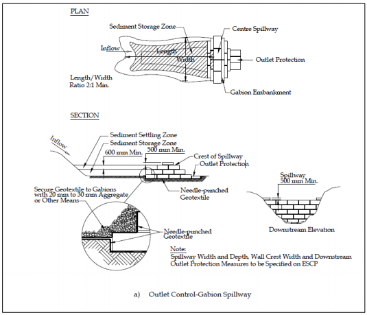
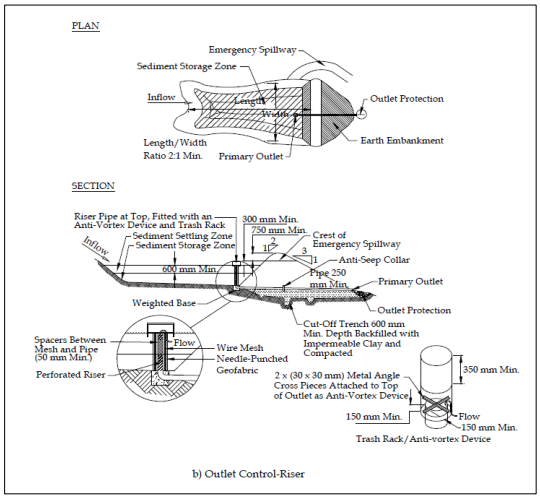
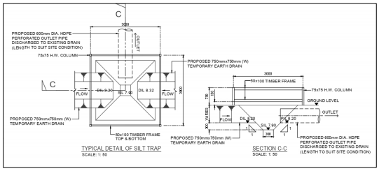
i. Runoff management and sediment control facilities i.e., temporary earth drains, check dams, silt fences, silt traps and sediment basins etc., to be provided at the site.

ii. Specifications, locations and sequences in the provision of runoff management and sediment control facilities.

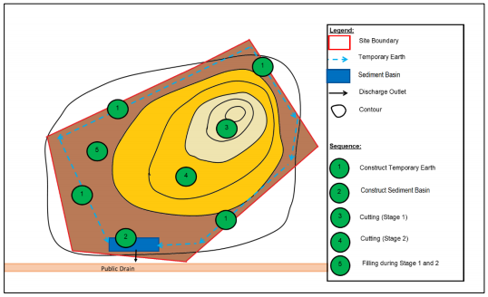
2. Construct runoff management and sediment control facilities at the site prior to carrying out earthwork activities. Below are general sequences for providing the facilities.

i. Mark site and/or buffer boundaries based on SOPs detailed in Environmental Condition: Control of Site Development.

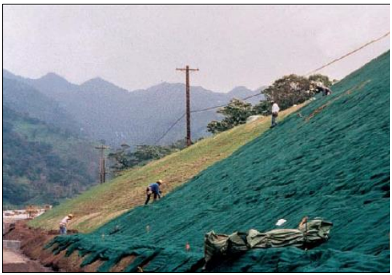
ii. Construct temporary perimeter earth drains and sediment basins prior to carrying out earthwork activities. Refer to Figure 5.

iii. Connect temporary earth drains to the sediment basin to divert all surface runoff into it.

Figure 5: Illustration of earthwork activity by stages.

Figure 6: Typical design of a Sediment Basin (1)

Figure 7: Typical design of a Sediment Basin (2).

Figure 8: Typical design of a Silt Trap.

3. No construction of runoff management and sediment control facilities in rivers or watercourses.

4. Conduct site clearing at the targeted phase of the development site based on the development schedule.

5. Conduct earthwork activities in stages at the targeted phase of the development site and avoid conducting activities during rainy days.

6. Compact exposed surfaces i.e., backfill areas, construct slope embankments, road base, etc., to reduce soil erosion.

7. Conduct maintenance (sediment removal or desiltation by excavation) on sediment control facilities i.e., temporary earth drains, check dam, and sediment basin, periodically with increasing frequency after each rain event.

8. Start applying temporary soil stabilisation methods to exposed areas after reaching final formation level on any portion of the site. Install plastic sheet covers or geotextile mats as temporary soil stabilisation measures.

Plate 7: Example of plastic sheet cover.

Plate 8: Example of geotextile mat.

9. Plant cover crops on exposed surfaces e.g., Mucuna bracteata, Brachiaria ruziziensis, etc. to reduce soil erosion.

Plate 9: Example of cover crops, Brachiaria ruziziensis, on an exposed area.

10. Refer to SOPs contained in Environmental Condition: Slope Stabilisation if cover crops are not suitable due to slope surface type, such as rocky slopes.

11. Place any earth materials stockpile (either imported from borrow pit or excavated at the site) at a minimum distance of 30 metres from any watercourse to avoid potential soil migration or the distance specified in the AEC / MD.

12. Provide temporary perimeter controls at the earth materials stockpile, such as berms, and cover the materials with canvas sheets.

Plate 10: Example of loose earth materials covered with canvas sheets.

13. No disposal of earth, biomass waste, sediment, solid waste, sewage or scheduled waste into the drainage, river or waterway.

14. Refer to the Malaysian Standard listed in Appendix 1 for additional reference on erosion and sediment control system.